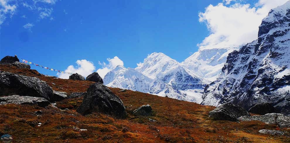
Mount Kanchenjunga stands as the third highest peak on Earth, located on the remote border between Nepal and India. Trekkers who want a quiet mountain experience choose the Kanchenjunga Circuit Trek Itinerary over busy trails near Everest. The route starts in eastern Nepal, passing the tea gardens of Fikkal and Kanyam to reach Taplejung. The first foot paths follow the Ghunsa Khola river through steep valleys to the villages of Sekathum and Amjilosa.
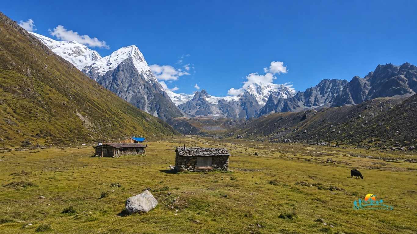
Higher up, bamboo forests open into alpine pastures where yaks graze under sharp granite peaks. This 23 day schedule includes rest days in the Sherpa village of Ghunsa and high Kambachen so your lungs can adjust to the thinning air. These breaks prepare you for the push to Lhonak. On Day 13, you hike to Pangpema, the North Base Camp at 5143 meters, where the Kanchenjunga glacier sits right before you.
The trail links both base camps by crossing the high Sele Le Pass, showing you both the north and south faces of the massif. You cross rugged ridges to reach Cheram and Ramche on the southern side, allowing a day trip to the Yalung Glacier. Finally, you descend through rhododendron forests to Rani Pul and drive to the plains for your flight back to Kathmandu.
Essential Fitness and Preparation for the High Altitude
You must prepare your body thoroughly before attempting this strenuous mountain journey. Trekkers walk between four and eight hours every day on rough, uneven ground. Cardiovascular training, such as running, cycling, or climbing stairs with a weighted backpack, builds the stamina you need for consecutive walking days. Strength training for your legs ensures your knees can handle the steep descents from high passes like Sele Le. Mental preparation helps you stay positive when staying in basic local teahouses with minimal comforts.
Key Highlights of the Remote Eastern Nepal Trail
This specific route offers rare attractions that you cannot find anywhere else in Nepal. The trail cuts through the Kanchenjunga Conservation Area, a protected zone that shelters rare wildlife like the red panda and the snow leopard. You walk through diverse climate zones, moving from subtropical river valleys to frozen high-altitude moraines. Visiting traditional villages like Ghunsa allows you to see the unique cultural lifestyle of the local Sherpa and Tibetan communities. Seeing both the north face from Pangpema and the south face from Oktang rewards your hard physical effort.
Kanchenjunga Circuit Trek Highlights
- Stand before the North Base Camp at Pangpema and the South Base Camp at Ramche.
- Cross the challenging Sele Le Pass at an altitude of 4390 meters.
- Walk through the protected Kanchenjunga Conservation Area to observe rare wildlife.
- See the expansive tea gardens of Fikkal and Kanyam during the overland drive.
- Observe the unique culture and traditional lifestyle of local Sherpa and Tibetan communities.
- Follow the scenic and powerful waters of the Ghunsa Khola and Tamor River.
Exclusive Benefits with Himalayan Gateway Trek
- We provide experienced, government-licensed local guides who know the eastern Nepal terrain accurately.
- Your booking includes all required restricted area permits and conservation fees with zero hidden costs.
- We handle your domestic flights between Kathmandu and Bhadrapur directly to ensure punctual transits.
- Our field team carries a pulse oximeter throughout the journey to monitor your oxygen levels daily.
- We secure the cleanest available local teahouses and traditional homestays along the entire remote route.
Kanchenjunga Circuit Trek Overview
Mount Kanchenjunga stands as the third highest peak on Earth, located on the remote border between Nepal and India. Trekkers who want a quiet mountain experience choose the Kanchenjunga Circuit Trek Itinerary over busy trails near Everest. The route starts in eastern Nepal, passing the tea gardens of Fikkal and Kanyam to reach Taplejung. The first foot paths follow the Ghunsa Khola river through steep valleys to the villages of Sekathum and Amjilosa.
Higher up, bamboo forests open into alpine pastures where yaks graze under sharp granite peaks. This 23 day schedule includes rest days in the Sherpa village of Ghunsa and high Kambachen so your lungs can adjust to the thinning air. These breaks prepare you for the push to Lhonak. On Day 13, you hike to Pangpema, the North Base Camp at 5143 meters, where the Kanchenjunga glacier sits right before you.
The trail links both base camps by crossing the high Sele Le Pass, showing you both the north and south faces of the massif. You cross rugged ridges to reach Cheram and Ramche on the southern side, allowing a day trip to the Yalung Glacier. Finally, you descend through rhododendron forests to Rani Pul and drive to the plains for your flight back to Kathmandu.
Booking your journey with Himalayan Gateway Trek guarantees a well-organized and safe expedition through this remote territory. Our team secures your required restricted area documentation and organizes every detail of the land and air transport smoothly. You walk alongside certified local guides who know every trail marker, river crossing, and emergency safety protocol from Taplejung to the high alpine passes. Trust Himalayan Gateway Trek to manage your logistics perfectly so you can focus entirely on reaching both base camps.
23 Days Kanchenjunga Circuit Trek Itinerary
Day 01: Arrival in Kathmandu and Transfer to Hotel
You land at the Tribhuvan International Airport in Kathmandu, where our representative meets you outside the arrivals terminal. A private vehicle transfers you directly to your hotel through the city streets.
Once you check into your room, you can unpack and rest after your international flight. You spend the evening relaxing or walking around the nearby tourist streets to prepare for the long journey ahead.
Day 02: Trek Preparation and Documentation Day
Our team collects your original passport to finalize the restricted area trekking permits with the immigration office. You meet your trekking guide for a thorough briefing session covering trail conditions, high altitude safety, and gear requirements.
You spend the afternoon checking your equipment list and buying or renting any missing mountain gear at local shops. The rest of the day remains free for you to rest before the morning travel.
Day 03: Fly from Kathmandu to Bhadrapur and Drive to Fikkal or Kanyam
You take an early morning flight from Kathmandu to Bhadrapur airport in the low plains of eastern Nepal. The flight offers clear views of the eastern Himalayan range if the weather is clear.
After landing, a private vehicle drives you north into the hills of the Ilam district. You pass vast tea gardens and terraced farms before arriving at your lodge in Fikkal or Kanyam for the night.
Day 04: Drive from Fikkal or Kanyam to Taplejung
The overland journey continues north along the Mechi Highway through winding mountain roads. You see small hill towns, fast rivers, and changing forest types as the vehicle gains altitude.
The drive ends in Taplejung, the major administrative hub of the region and the formal gateway to the trek. You check into a local lodge and prepare your backpacks for the first day of foot travel.
Day 05: Trek from Taplejung to Sekathum
You begin walking by descending toward the Tamor River valley through traditional agricultural villages. The trail crosses several suspension bridges and follows a rough dirt road track down to the riverbed.
You follow the river upstream, passing small cardamom plantations and bamboo groves. The trail leads directly to the small settlement of Sekathum, where you stay in a basic local teahouse.
Day 06: Trek from Sekathum to Amjilosa
The path leaves the Tamor River and follows the steep, narrow gorge of the Ghunsa Khola. You walk along a rocky track that climbs sharply over steep ridges and drops back down to the river banks.
The valley narrows significantly, creating a wild atmosphere with rushing waterfalls and dense forest cover. A final steep climb brings you out of the gorge to the small Tibetan settlement of Amjilosa.
Day 07: Trek from Amjilosa to Gyabla
You walk through a dense forest of rhododendron, bamboo, and oak trees as the trail continues along the river valley. The incline is gentler today, though it features a few short, rocky climbs.
You pass a few temporary herder shelters before climbing a final steep section to reach Gyabla. This small village sits on a flat hill clearing, offering your first taste of traditional Tibetan highland culture.
Day 08: Trek from Gyabla to Ghunsa
The trail descends slightly into the river valley before opening into a wider alpine area. You pass through the village of Phale, a Tibetan refugee settlement known for traditional handicrafts and wooden houses.
After Phale, you cross a final wooden bridge over the Ghunsa Khola to enter Ghunsa. This is the largest Sherpa village in the upper valley, featuring stone houses, ancient monasteries, and better teahouses.
Day 09: Acclimatization Day in Ghunsa
You stay in Ghunsa for a mandatory rest day to help your body adapt to the altitude above three thousand meters. Proper rest here prevents altitude sickness before you climb into the true high alpine zones.
Your guide leads a short adaptation hike up the ridges toward the Yamatari Khola valley or a local viewpoint. You return to the village for lunch, leaving the afternoon free to wash clothes or talk with locals.
Day 10: Trek from Ghunsa to Kambachen
The trail climbs gradually north through pine and larch forests along the eastern bank of the river. You enter a wild glacier valley where the tree line disappears, replaced by low shrubs and rocks.
You cross a rocky landslide zone with care, following your guide across the scree slopes. The path then drops to a riverbed before rising to Kambachen, a seasonal settlement surrounded by high snow peaks.
Day 11: Acclimatization Day in Kambachen
You spend a second planned adaptation day in Kambachen because you are now entering extreme altitudes. Giving your lungs an extra day to adjust ensures you have the stamina for the base camp trails.
You take a short morning walk to a nearby glacier frozen lake or toward the base of Jannu Peak. You spend the rest of the day resting inside the teahouse dining room to save your physical energy.
Day 12: Trek from Kambachen to Lhonak
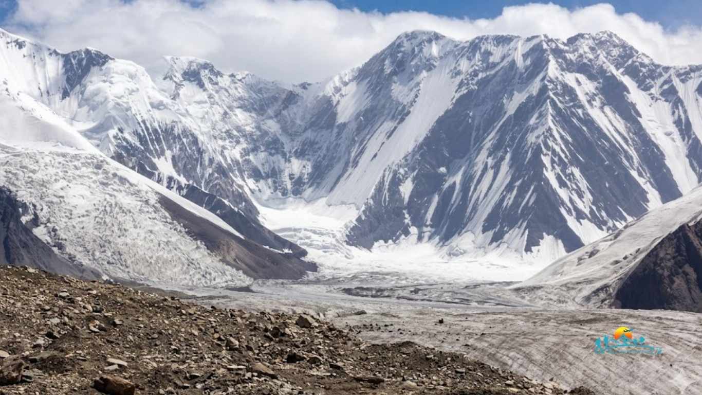
The path scales rough moraine walls and follows the edge of the massive Kanchenjunga glacier. Walking becomes more difficult and slower due to the thin air and loose rocks underfoot.
You cross a final boulder field where the valley opens into a wide, windy plain. You reach Lhonak, a basic settlement of a few stone teahouses sitting on a sandy plain opposite the glacier.
Day 13: Day Trip to Kanchenjunga North Base Camp (Pangpema)
You start very early to hike along the edge of the lateral moraine toward Pangpema, the North Base Camp. The trail requires careful stepping over loose scree and frozen ground, but the surrounding mountain views are clear.
You reach the base camp viewpoint, where the north face of Mount Kanchenjunga rises directly above you. After taking photos of the glacier and peaks, you walk back down to Lhonak for the night.
Day 14: Trek from Lhonak back to Ghunsa
You turn back and begin your long descent down the valley, retracing your steps along the glacier moraine. Dropping in altitude makes breathing noticeably easier, allowing you to move at a faster pace.
You pass through Kambachen for lunch before continuing down through the alpine pastures and larch forests. You reach the familiar village of Ghunsa by late afternoon to enjoy a comfortable night.
Day 15: Trek from Ghunsa to Sele Le
The path leaves the main northern trail and climbs steeply up through dense juniper and rhododendron forests. This route cuts across the high mountain ridges to link the northern and southern sides of the circuit.
The forest disappears as you reach the rugged high ridges. You finish the day at Sele Le, an isolated camp consisting of basic stone shelters used primarily by trekkers crossing the pass.
Day 16: Trek from Sele Le to Cheram via the High Passes
Today brings a strenuous crossing over a series of high mountain passes, including the Mirgin La and Sinion La. You walk across rocky ridges that offer views of Makalu and the Kanchenjunga range.
After crossing the final high ridge, the trail drops down a long, steep rocky scree slope. The descent ends in the Simbuwa Khola valley, leading you to the small forest clearing of Cheram.
Day 17: Day Trip to Kanchenjunga South Base Camp and Trek to Ramche
You walk up the valley alongside the Yalung Glacier moraine to reach the high pasture of Ramche. You leave your main packs at the lodge and continue toward the Oktang viewpoint, the South Base Camp area.
This spot offers a clear look at the south face of Kanchenjunga and its massive frozen icefalls. You spend time taking photos before walking back down to the stone teahouses in Ramche.
Day 18: Trek from Ramche to Torongding
You begin your return journey by walking back down through the Simbuwa Khola river valley. The path drops steadily through subalpine bushes and enters thick rhododendron and mossy pine forests.
The walking is entirely downhill today, which eases the strain on your lungs but requires careful stepping on tree roots. You reach the small forest settlement of Torongding to spend the night.
Day 19: Trek from Torongding to Rani Pul
The trail climbs up over the Lasiya Bhanjyang pass through dense bamboo and rhododendron forests. This is the final major climb of the trek, involving a steep track that can be muddy after rain.
From the top of the pass, you make a long, steep descent down toward the lower river valleys. The path brings you out at Rani Pul, where the walking trail officially ends and joins the dirt road.
Day 20: Drive from Rani Pul to Taplejung
You leave the footpaths behind and board a local four-wheel-drive jeep at Rani Pul. The vehicle drives along rough mountain roads that follow the path of the river back toward the main towns.
The bumpy drive climbs back up the hillsides to end at the main town of Taplejung. You check into a comfortable local lodge and celebrate finishing the trekking circuit with your guide and porters.
Day 21: Drive to Bhadrapur and Fly back to Kathmandu
An early morning drive transfers you from the hills of Taplejung back down to the low plains of Bhadrapur. You check in at the domestic airport terminal for your return flight to the capital city.
The fifty-minute flight lands at the Kathmandu airport, where a private vehicle waits to take you back to your hotel. You enjoy a hot shower and spend the evening resting or shopping for souvenirs.
Day 22: Rest and Buffer Day in Kathmandu
This day serves as a buffer in case of any flight delays or road blocks during your return journey from eastern Nepal. You can use this free time to sleep, visit local cafes, or see historic temples in the city.
Our team can organize a guided sightseeing tour around the historical squares of Kathmandu if you request it. You pack your bags in the evening and prepare for your international departure.
Day 23: Final Departure from Kathmandu
Your 23 day mountain journey in eastern Nepal comes to an official end today. A private vehicle collects you from your hotel lobby three hours before your scheduled flight time.
The driver transfers you directly to the international terminal at Tribhuvan International Airport for your flight back home. You board your aircraft with lifetime memories of the remote trails around Mount Kanchenjunga.
What is Included in the Kanchenjunga Circuit Trek Package
- Airport pick up and drop by private car.
- Twin sharing hotel accomodation in Kathmandu with breakfast (3* catagories).
- Breakfast (17 ),Lunch (18 )& Dinner (18) during the trek.
- Teahouse accomodation during the trek.
- Flight from Kathmandu to Bhadrapur to Kathmandu.
- All private overland jeep transport as per the itinerary
- An experienced, English-speaking and government-licensed trekking guide.
- Porter service ( 1 porter : 2 trekkers )
- Kanchenjunga Conservation area permit
- Restricated area permit.
- Insurance of guide & porters.
- Farewell dinner
- Trekking certificate
- Sleeping bag to each trekkers (to be returned after trip completion)
- Basic First Aid Medical kit (carried by guide)
- Travel & rescue arrangement (Helicopter evacuation available if required, at clients cost based on clients insurance policy
What is Excluded from the Kanchenjunga Circuit Trek Package
- International flights
- Nepal visa fee
- Personal trekking gear
- Extra night accommodation in Kathmandu due to early arrival or late departure, or early return from the trek.
- Hot showers, battery charging, and Wi-Fi services.
- Extra expenses arising from unpredictable flight delays, road blocks, or weather changes.
- Tips to guide & Porters
Packing the correct gear determines your safety and comfort on this 23 day alpine journey. The trail crosses diverse climate zones, moving from hot subtropical valleys to freezing glacial plains above five thousand meters. You must pack high quality layers to handle sudden temperature drops and rugged mountain terrain.
Porters carry your main duffel bag up to a strict weight limit of 15 kilograms, while you carry your own daypack for immediate needs during the walk. This list covers the mandatory clothing, footwear, sleeping gear, and personal safety accessories you need to complete the circuit successfully.
- Sturdy, broken-in trekking boots with deep rubber grips and rigid ankle support.
- Multiple pairs of thick wool blend trekking socks and thin moisture-wicking liner socks.
- Windproof and waterproof down jacket rated for temperatures down to minus 15 degrees Celsius
- Waterproof shell jacket and matching waterproof trousers for rain and snow protection.
- Thermal base layer tops and bottoms made of merino wool or high-performance synthetic fabric.
- Quick-drying trekking shirts and lightweight hiking trousers with zip-off options.
- Warm fleece hat, wide-brimmed sun hat, and UV-blocking mountain sunglasses.
- Lightweight inner gloves and heavy, waterproof outer gloves or mittens.
- Four-season sleeping bag rated for minus 15 degrees Celsius with a durable compression sack.
- A 35 to 45 liter daypack with a rain cover for your daily camera, water, and extra layers.
- Bright LED headlamp with extra lithium batteries or a portable USB charging cable.
- Two wide-mouth water bottles or a durable hydration bladder totaling at least 3 liters capacity.
- Personal first aid kit containing blister tape, painkillers, rehydration salts, and altitude medication.
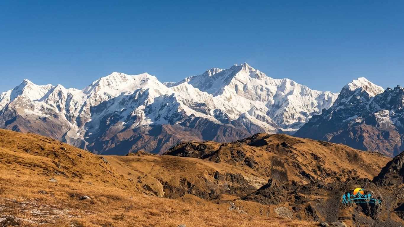
The 23 day Kanchenjunga Circuit Trek stands as one of the most demanding wilderness walking routes in eastern Nepal. This package takes you deep into the borderland between Nepal and India to trace both the North and South Base Camps of the third highest mountain on earth. Your journey begins with a short domestic flight from Kathmandu to the lowlands of Bhadrapur before a private jeep drive carries your group up through the terraced tea gardens of Ilam toward the gateway town of Taplejung.
As you cross the boundary into the Kanchenjunga Conservation Area, the trail follows the roaring waters of the Tamur and Ghunsa rivers. You walk through diverse alpine microclimates, ascending from subtropical valleys filled with cardamom plantations to the stark glacial moraines above five thousand meters. Along these isolated paths, the protected wilderness shelters rare alpine species, creating opportunities to spot signs of the snow leopard, red panda, and Himalayan blue sheep.
This remote expedition requires solid physical conditioning and mental stamina due to consecutive days of long hiking on rugged trails. Trekkers overnight in simple local teahouses, sharing space with the native Sherpa, Rai, Limbu, and Tibetan-origin communities who preserve centuries-old cultural practices. Government regulations mandate a licensed guide and a minimum group size of two individuals to enter this restricted border zone.
Dual Base Camp Access and Glacial Formations
Trekkers stand at both Pangpema, the North Base Camp at 5,140 meters, and Oktang, the South Base Camp at 4,800 meters. These vantage points reveal close views of the massive Yalung and Kanchenjunga glaciers alongside towering vertical ice walls.
High Altitude Pass Crossings and Elevation Challenges
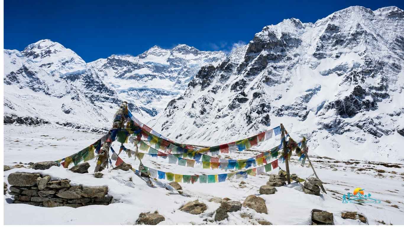
The route tests your endurance during successive crossings of the high-altitude Sele La, Mirgin La, and Sinelapcha passes. You cross these rocky ridges to connect the northern and southern trail arms, handling steep slopes to reach a maximum walking elevation of 5,388 meters.
Biodiversity Within the Protected Conservation Area
The entire walking route stays within the protected boundaries of the Kanchenjunga Conservation Area. You walk past cascading alpine waterfalls, deep bamboo thickets, and old forests of oak and rhododendron that house hundreds of distinct avian species.
Authentic Cultural Encounters in Restricted Border Villages
The isolated border location preserves the undisturbed ways of life of the local inhabitants. You spend time in traditional stone villages like Ghunsa and Phale, visiting ancient Buddhist monasteries and observing high-altitude yak herding directly.
Terms & Policies
Thank you for choosing Himalayan Gateway Trek. Our goal is to provide a safe, enjoyable, and memorable travel experience. Please review the following terms and policies before confirming your booking.
📍Booking & Payment
- 👉 A 20% deposit is required to confirm your booking.
- 👉 The remaining balance must be paid on your arrival day in Nepal
- 👉 Your booking is confirmed once we receive your deposit and send a confirmation.
📍Cancellation & Refunds
- 👉 If you cancel your trip 45 days or more before departure, 50% of the deposit amount will be refunded.
- 👉 No refunds are available for cancellations made within 45 days of departure.
- 👉 Any non-refundable costs already incurred, including permits, flights, accommodation, transportation, or other third-party services, will be deducted from the refund amount.
Note: Eligible refunds will be processed within 14 business days of receiving the cancellation request.
📍 Travel Insurance
- 👉 Travel insurance is mandatory for all trekking and adventure trips.
- 👉 Your insurance should cover emergency medical treatment, helicopter evacuation, trip cancellation, and personal accidents.
- 👉 Himalayan Gateway Trek is not responsible for expenses arising from inadequate insurance coverage.
📍 Trip Changes
- 👉 Weather conditions, flight delays, road conditions, government regulations, or other unforeseen circumstances may require changes to the itinerary.
- 👉 Any changes will be made with the safety and well-being of our guests as the highest priority.
📍 Responsibility
- 👉 Himalayan Gateway Trek is not responsible for flight delays, cancellations, injuries, loss of personal belongings, natural disasters, political unrest, or other events beyond our control.
- 👉 By booking a trip with us, you acknowledge and accept the inherent risks associated with trekking and adventure travel.
FAQs
How difficult is the Kanchenjunga Circuit Trek?
This demanding trek ranks as highly challenging due to its remote paths and steep glacial moraines. You will walk six to eight hours daily across high mountain passes. The route requires great physical stamina and previous alpine trekking experience.
What permits do I need for the Kanchenjunga Circuit Trek?
You must obtain two distinct permits before starting your journey. These include the Kanchenjunga Restricted Area Permit and the Kanchenjunga Conservation Area Permit. A registered local agency must process these official documents for your group in Kathmandu.
How long does it take to climb Kangchenjunga?
Climbing Mount Kanchenjunga typically takes around 48 to 58 days from Kathmandu. The long expedition includes a multi-day approach trek, nearly a month of high-altitude climbing, and necessary rest periods for proper acclimatization.
How much does it cost to trek Kanchenjunga?
A standard Kanchenjunga trek package costs between 1,500 and 2,500 US dollars per person. This total price covers mandatory entry permits, professional guides, porters, daily meals, and basic local teahouse accommodations.
What is the best trek to see Kanchenjunga?
The full Kanchenjunga Circuit Trek provides the absolute best experience by visiting both the north and south base camps. You cross high passes to see massive glacial walls and towering mountain peaks completely.
Can I do a solo trek to Kanchenjunga?
No, the government prohibits independent or solo trekking in this restricted border zone. Regulations mandate that you hire a licensed guide and travel with a minimum group size of two trekkers to secure the necessary official entry permits.
What is the best season to do the Kanchenjunga Circuit Trek?
Spring from March to May and autumn from September to November offer the most stable conditions. These months provide clear skies, excellent visibility of high peaks, and dry walking trails while avoiding heavy winter snow or summer monsoon downpours.
What type of food and accommodation can I expect?
Local families open basic teahouses providing shared rooms with simple mattresses. Trail kitchens serve fresh meals filled with carbohydrates, including traditional dal bhat, seasonal vegetables, noodles, eggs, and hot soups to sustain your long daily walks.
What is the maximum altitude reached on this trek?
You reach the highest point at Pangpema, the North Base Camp, sitting at an elevation of 5,143 meters. The route also crosses several mountain passes like the Sele La that exceed 4,000 meters above sea level.
Is electricity, battery charging, and Wi-Fi available on the trail?
Lower villages provide limited solar electricity for device charging, but connections disappear as you climb higher. Some teahouses offer satellite internet services for an extra fee, though connectivity remains highly unstable and frequently drops entirely.
What happens in case of an emergency or altitude sickness?
Your guide monitors your physical symptoms daily and carries a basic first aid medical kit. If you develop severe altitude sickness, the team arranges immediate evacuation by emergency helicopter rescue to a hospital in Kathmandu.